The short answer
In England a garden room can still be permitted development in a conservation area. Class E adds one restriction there: no part of the building may sit on land between a side wall of the house and the boundary of the garden. National Parks, National Landscapes, the Broads and World Heritage Sites add a 10 m² cap beyond 20 m from the house. The other nations differ.
A conservation area is the first thing people check and the last thing they understand. Most assume it means an application for everything. In England, for a garden room at the back of the garden, it usually does not. It means one extra restriction, and it is a restriction about where the room goes.
What “article 2(3) land” is
The permitted development rules for garden buildings do not mention conservation areas one by one. They use a label. Article 2(3) of the 2015 Order says that the land it calls article 2(3) land is the land described in Part 1 of Schedule 1 to the Order, and the Order’s own summary of that list is “National Parks, areas of outstanding natural beauty and conservation areas etc” (GPDO 2015, article 2).
The government’s technical guidance spells the label out in plain words. It says article 2(3) land includes land within a National Park, the Broads, an area of outstanding natural beauty, a conservation area, and World Heritage Sites (technical guidance for householders, MHCLG, September 2019, page 6). An area of outstanding natural beauty is what is now often called a National Landscape; the Order still uses the older name.
Two things follow:
- Class E does not treat a conservation area as a special case. It treats article 2(3) land as one group, with one extra limit.
- A second, narrower limit applies to some of the other designations in that group but, in England, not to conservation areas. That is the 20 m rule below.
Whether your garden is article 2(3) land is a fact about your address, not a judgment call.
Garden room rules in England
Conservation areas: the side-of-house ban
Paragraph E.3 of Class E reads: in the case of any land within the curtilage of the dwellinghouse which is article 2(3) land, development is not permitted if any part of the building, enclosure, pool or container would be situated on land between a wall forming a side elevation of the dwellinghouse and the boundary of the curtilage (Class E, GPDO 2015).
The technical guidance (page 45) puts it more simply: in these areas, buildings sited on land between a side wall and the boundary of the land surrounding the house are not permitted development.
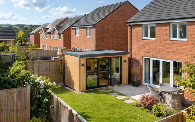
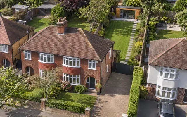
In practice this is a test of position, and the way people fail it is by measuring the wrong thing. The ban covers any part of the building. A room whose main body sits at the bottom of the garden but whose corner or overhang reaches into the strip beside the house wall has failed. Draw the line out from each side wall of the house to the boundary and keep the whole room clear of it.
A terraced house usually has no side garden to worry about. A semi-detached or detached house often has a gate and a path down the side, and that is the land the ban covers. If your plan was to put a studio beside the house, in a conservation area it needs an application.
National Parks, National Landscapes, the Broads and World Heritage Sites: the 20 m rule as well
Paragraph E.2 applies a second limit on top. For land in an area of outstanding natural beauty, the Broads, a National Park or a World Heritage Site, development is not permitted if the total area of ground covered by buildings, enclosures, pools and containers more than 20 metres from any wall of the house would exceed 10 square metres (Class E, GPDO 2015).
A conservation area is not in that list. So in England, a long garden in a conservation area does not pick up the 10 m² cap, but the same garden inside a National Park would. If your house is in a conservation area that also lies within one of the other designations, both limits apply.
The 20 m is measured from any wall of the dwellinghouse, and it counts everything beyond that line: other outbuildings, a pool, a container. A summerhouse already at the far end of the garden uses up part of the 10 m².
Everything else in Class E still applies
Being in a conservation area removes nothing from the ordinary Class E tests and adds only the limits above. The height limits, the single storey, the 50% coverage cap, the rule against building forward of the front of the original house, the ban on verandahs, balconies and raised platforms, and the rule that the building must be incidental to the house all still apply. The full list, with each clause, is in Class E explained.
Two other things sit outside Class E and catch people in conservation areas. An Article 4 direction can remove the rights altogether, and your council can tell you whether one covers your area; see Article 4 and removed rights. And if any part of your garden is the curtilage of a listed building, Class E does not apply at all; see garden rooms and listed buildings.
The other nations
The three other nations use the same idea with different lines. The table sets out what each order says; check the wording for your address before relying on it.
| Nation | Where the rule applies | What it says |
|---|---|---|
| England | Conservation areas, National Parks, National Landscapes (AONBs), the Broads, World Heritage Sites | Nothing between a side wall and the boundary (E.3) |
| England | National Parks, AONBs, the Broads, World Heritage Sites only | 10 m² cap beyond 20 m from the house (E.2) |
| Wales | Article 1(5) land, which includes conservation areas, and World Heritage Sites | Both limits together: 10 m² beyond 20 m, and nothing between a side wall and the boundary (E.2) |
| Scotland | Conservation areas | Footprint of the building 8 m² at most (Class 3A(2)(h)) |
| Northern Ireland | Conservation areas, World Heritage Sites, National Parks, AONBs | Nothing between the principal or a side elevation and the boundary (D.3) |
| Northern Ireland | World Heritage Sites, National Parks, AONBs, not conservation areas | 10 m² cap beyond 20 m from the house (D.2) |
Wales
Paragraph E.2 of the Welsh Class E applies on article 1(5) land and in World Heritage Sites. It has two limbs: the 10 m² cap beyond 20 m from the house, and the side-land ban. Article 1(5) land is the land described in Part 2 of Schedule 1 (National Parks, areas of outstanding natural beauty and conservation areas etc), so a Welsh conservation area gets the 20 m rule that an English one does not. The Welsh rules differ from England in other ways too: see Wales.
Scotland
Scotland takes a different route. Class 3A caps a building at a footprint of 8 square metres in a conservation area, a limit inserted from 1 April 2021 by SSI 2020/437 (revised text of the 1992 Order). The same class does not restrict National Parks, National Scenic Areas or World Heritage Sites. In practice that means a conservation area in Scotland is far tighter than in England: a room of the size most people want exceeds 8 m² and needs an application. See Scotland.
Northern Ireland
Class D has the side-land ban in D.3 for conservation areas, World Heritage Sites, National Parks and areas of outstanding natural beauty, and it is wider than the English one: it covers land between either the principal elevation or a side elevation and the boundary, so in practice the room goes in the rear garden only. The 20 m rule in D.2 covers World Heritage Sites, National Parks and AONBs, not conservation areas. See Northern Ireland.
How to check your address
Do this before you design anything. A room drawn for the wrong rule is a wasted drawing.
The planning data site
The government’s planning data site publishes a conservation area dataset for England, which it describes as areas of special architectural or historic interest, and it lets you explore the data on a map. Its own page warns that the data may be incomplete and not yet cover all of England (planning.data.gov.uk, conservation area dataset, read 19 November 2026). Use it as a first look, not as proof.
The council’s conservation area map
Your council is the body that designates and maps its conservation areas, so its map, or a call to its planning team, is the answer that counts. Most councils publish a map or a list of conservation areas on their website. Ask two things: is the address inside the boundary, and is there an Article 4 direction on the area. Boundaries can run down the middle of a road or cut through a garden, so check the exact plot rather than the street.
Article 4 directions often sit on top
A conservation area can carry an Article 4 direction, which takes away rights that Class E would otherwise give. Some cover outbuildings and some do not, so the wording of the direction matters. Your council can tell you which applies, and the Article 4 guide shows where to look.
Check with your council
Ask the council one clear question
Ask whether the address is in a conservation area, and whether any Article 4 direction removes rights for outbuildings there. Get the answer in writing. It is the fact the rest of the design depends on.
If you need an application
If the room cannot be permitted development, because it sits beside the house, exceeds the Scottish footprint, or an Article 4 direction applies, the route is a householder application. In a conservation area, ask your council whether its validation list asks for a heritage statement on the effect of the garden room on the area. The householder application guide covers the forms, the fee and what a drawing set should show. Your council decides; what you can do is give it a clear, accurate set of drawings.
Prove it in writing
If the room does meet the rules, the way to remove doubt is a certificate of lawfulness of proposed development, which asks the council to confirm in writing that the room is lawful. In a conservation area that confirmation is worth having, because a neighbour, a buyer’s solicitor or an enforcement officer may all ask later whether the room needed permission. The certificate and what it costs are in the lawful development certificate guide.
The free 3D check asks whether the address is in a conservation area, a National Park or another designation, and reads your design against the rules above. It shows how the design reads against the rule; your council decides.
Sources
Every number in this guide that does not come from our own 3D check was checked against these 8 documents, numbered in the order the text first cites them and read between 11 November 2026 and 19 November 2026. 8 are legislation and government guidance.
- 1legislation.gov.ukThe Town and Country Planning (General Permitted Development) (England) Order 2015, Schedule 2, Part 1, Class E (legislation.gov.uk, revised text)
- 2legislation.gov.ukGPDO 2015, article 2: height measured from the highest ground next to the building; article 2(3) land; flats are not dwellinghouses for Part 1
- 3GOV.UKPermitted development rights for householders: technical guidance (MHCLG, September 2019), pages 6 to 13 and 41 to 46
- 4Planning Data (MHCLG)Planning Data (MHCLG): article 4 direction area dataset for England; the data may be incomplete and not yet cover all of England
- 5legislation.gov.ukThe Town and Country Planning (General Permitted Development) Order 1995, Schedule 2, Part 1, Class E as substituted for Wales by SI 2013/1776 (W.177), revised text
- 6legislation.gov.ukGPDO 1995, article 1: interpretation, article 1(5) land, height measurement
- 7legislation.gov.ukThe Town and Country Planning (General Permitted Development) (Scotland) Order 1992, Schedule 1, Part 1, Class 3A as substituted by SSI 2011/357 and amended by SSI 2020/437, revised text
- 8legislation.gov.ukThe Planning (General Permitted Development) Order (Northern Ireland) 2015, Schedule, Part 1, Class D, revised text